


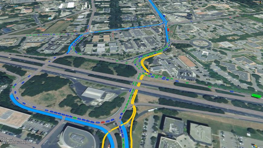
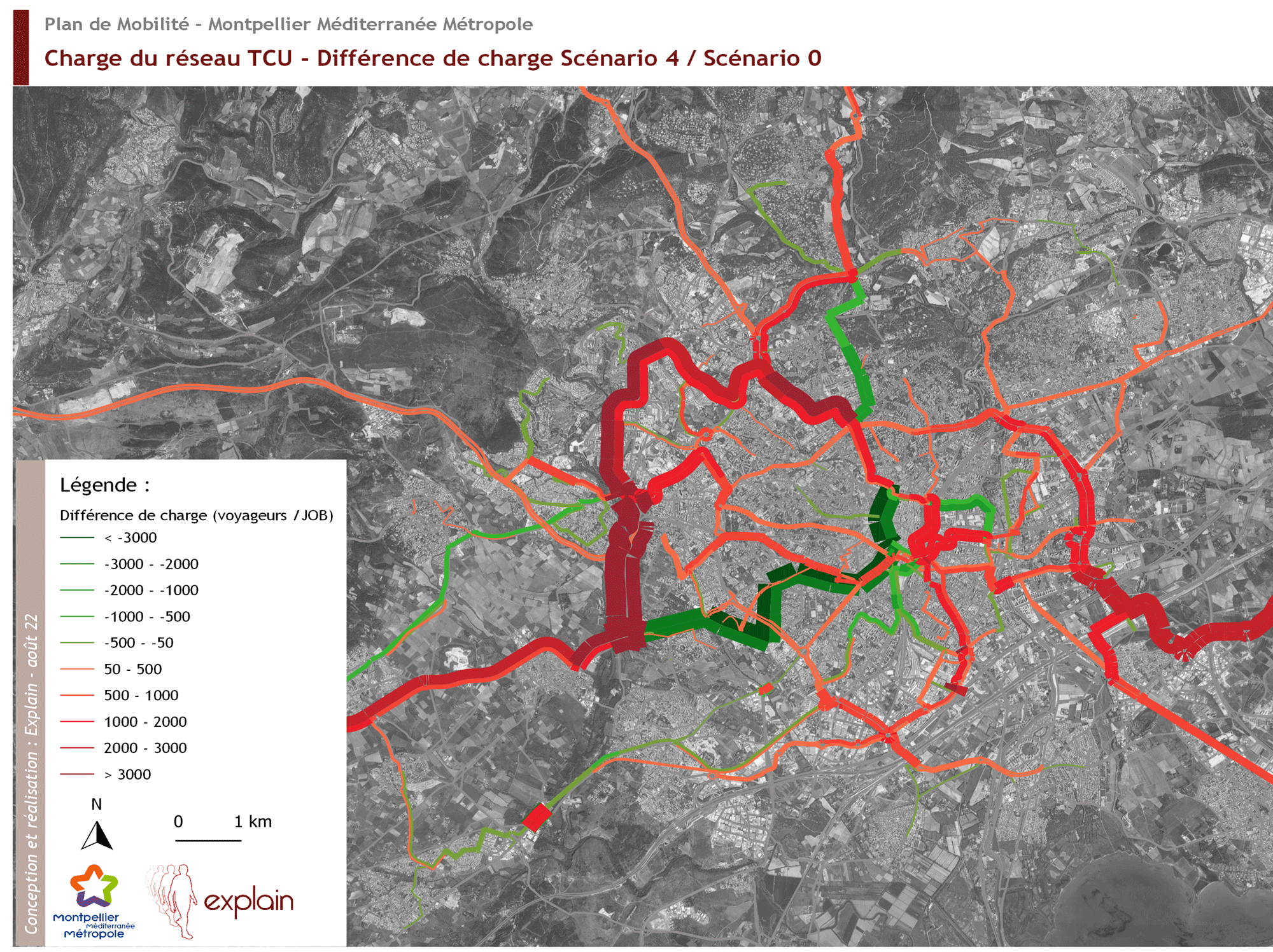
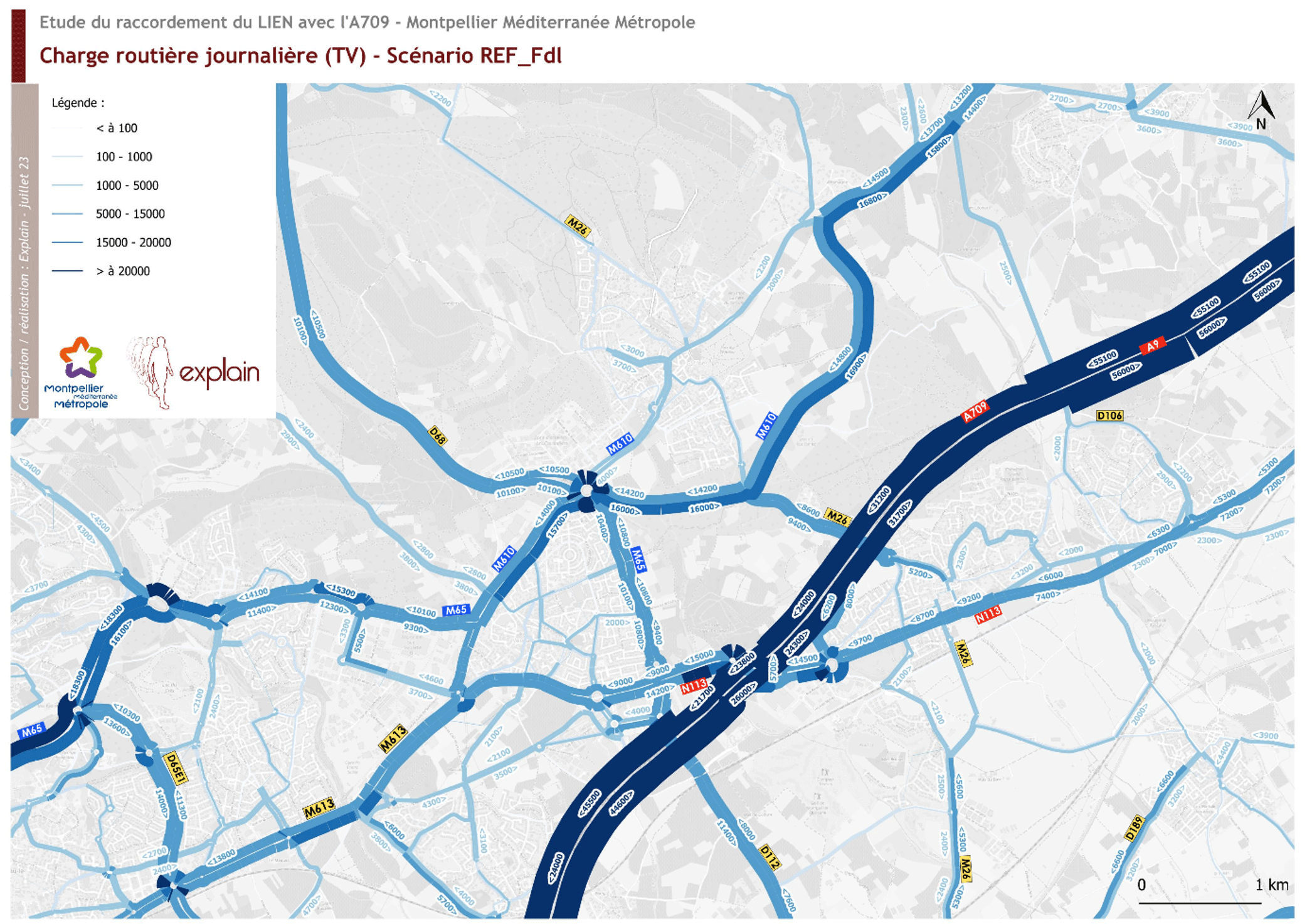
Modelling is an essential tool for understanding, forecasting and evaluating mobility dynamics. It makes it possible to test the effects of a development project, a new transport offer or a pricing policy before they are implemented. Explain develops or adapts macroscopic, microscopic, strategic or LUTI models, whether static or dynamic, to offer decision-makers an objective and reliable vision of possible evolutions.
Thanks to simulation, territories have a prospective reading of impacts: evolution of flows, modal reports, environmental effects, accessibility, level of service. Our models apply at all spatial scales, from the neighborhood to the national level, including the metropolis or the region, in order to meet the diversity of planning and operating challenges. Explain is also distinguished by its ability to design tailor-made methods, adapted to each problem. Beyond territorial applications, our teams conduct methodological and applied research work, contributing to the evolution of modeling practices in France: estimation of time values, flow-speed curves, integration of teleworking, modeling of goods flows or traffic forecasts at the national level.
We combine scientific requirement and pedagogy : our models are methodologically robust while remaining legible and usable for elected officials, technicians and actors involved.EXPLAIN acts both as director and prescriber : we develop innovative tools (machine learning, fine modeling in a quarter of an hour, multimodal or combined rail-road approach) and disseminate reference methods in the service of more sustainable and better understood mobility.We combine scientific rigor and pedagogy. Our simulations are designed to be robust from a methodological point of view, while remaining readable and useful for elected officials, technicians and stakeholders involved in the decision.


.jpg)

%20(1).webp)