
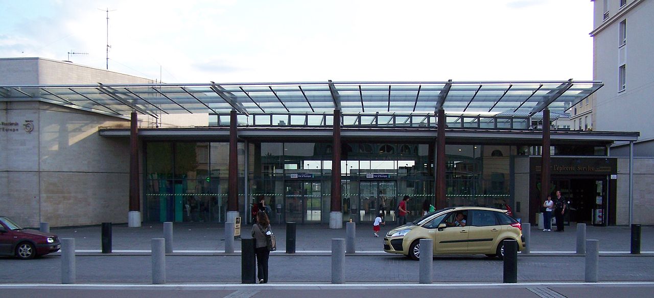


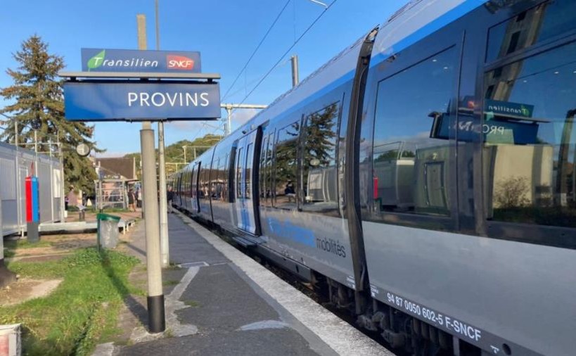
Provins station, the terminus of the Transilien line P, has seen a sharp increase in attendance since the electrification of the Paris—Provins line. Faced with the saturation of car parks and the prospect of new land developments, the community wanted to have an accurate diagnosis of uses around the station cluster.
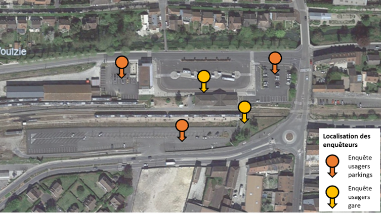
The study conducted by Explain combined field surveys among station and car park users, parking occupancy and rotation surveys, as well as a detailed analysis of drawdown practices. Two successive survey campaigns, conducted in 2023 and 2024, made it possible to cross-reference the data and ensure the robustness of the results.
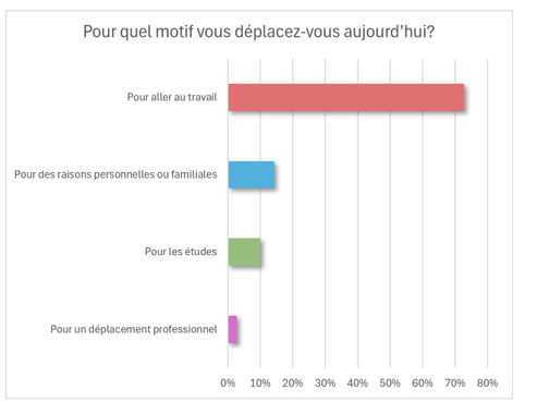
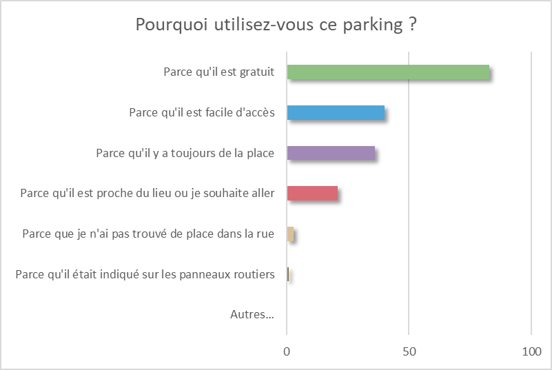
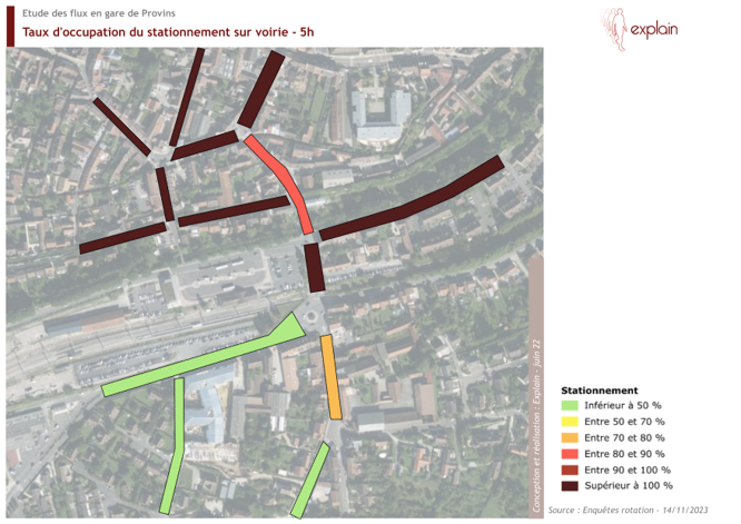
The observations highlighted a mostly local user profile: 80% of travelers live in Provins, and more than half reach the station on foot. While commuting to and from work dominates (73%), car pressure remains marked, with almost total occupancy of car parks as early as 7 am and a significant proportion of vacuum vehicles.
The analysis showed that, despite a theoretically sufficient offer, real availability is reduced by long-term parking. Parking management, more than its extension, is therefore the main driver for improvement. Finally, the study highlights the opportunity to strengthen active mobility and to requalify uses around the station to make it a genuine multimodal exchange hub.
As part of the revaluation of the railway site of Provins, the Communauté de communes du Provinois wanted to better understand the mobility practices linked to the station and the uses of the surrounding areas.
The challenge: to design a balanced layout between drawdown parking, the needs of local residents and multimodal accessibility.
Explain conducted a campaign of surveys and surveys on site, combining several tools:
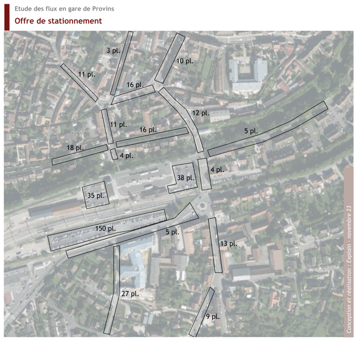
The data collected made it possible to establish a comprehensive diagnosis of drawdown practices, to identify the main areas of pressure on parking and to characterize demand according to user profiles (travelers, inhabitants, employees).
The cross-analyses also highlighted the specific needs of each audience and possible levers of action: shared parking management, creation of bicycle spaces, reorganization of traffic, signage.
A comprehensive study to inform planning decisions for the station hub and improve parking management.
The study allowed the Communauté de Communes du Provinois to better understand mobility behaviors and to objectify the real needs in terms of parking and intermodality. The results constitute a strategic work base for the definition of future development, by guaranteeing its coherence with local uses and expectations. By mobilizing its expertise in field surveys and behavioral reading, Explain offered to the community a clear, measurable and actionable vision for its planning.
The drawdown study for the Provins station made it possible to link observation, analysis and development strategy, by laying the foundations of a sustainable and concerted accessibility project at the service of the territory.


%20(1).webp)